Top of biosphere Brienzer Rothorn
The experience of Lucerne’s highest mountain
The Brienzer Rothorn towers impressively over the Entlebuch and, at 2,350 m, is the highest mountain in the canton of Lucerne. The imposing mountain massif offers views of 693 peaks, the turquoise-blue Lake Brienz and the UNESCO Biosphere Entlebuch.
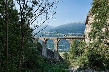
Travel comfortably by train to Schüpfheim. Then take the Postbus to «Sörenberg, Rothornbahn» and take the Sörenberg cable car to Brienzer Rothorn.

Top of biosphere
Rothorn summit restaurant
The renovated self-service restaurant impresses with its panoramic windows and great views. You can also enjoy culinary delights on the fantastic panoramic terrace. Down-to-earth, rustic, but always good for a surprise. The culinary events are particularly popular, for example the Fondue-Chinoise evening, the Seniors' Day on Tuesdays, or the breakfast buffet after the sunrise cruises.
Top of biosphere experience
The “Top of biosphere” visitor attraction offers a unique experience that focuses on the UNESCO Entlebuch Biosphere. It combines the impressive nature of the highest point of the biosphere with the themes of sustainability and the future. The centerpiece is the Biosphere Forum, which, after a cinematic interlude, creates a new way of broadening horizons.
Highlights
Mountain aficionados and hiking enthusiasts will find all their hearts desire on the Brienzer Rothorn, the highest peak in Canton Luzern. A first-rate 360° view that takes in the Eiger, Mönch and Jungfrau, along with up to 690 other peaks, is just waiting to be enjoyed. The cable car from Sörenberg takes you to this magnificent viewpoint in just ten minutes.
Hiking only? Far from it! The Brienzer Rothorn offers something for everyone. For adventure enthusiasts, for example, there are the sunrise and sunset rides, a unique experience, and for hikers there is the ambitious Ibex Trek over part of the world-famous Brienz Ridge. For nature lovers, the Eisee lake is perfect for fishing or relaxing. For connoisseurs, there are many culinary events in the newly renovated Rothorn summit restaurant or on the new culinary tour, where you hike from summit restaurant to summit restaurant. And the Rothorn photo trail offers unique souvenir photos of the excursion on Lucerne's highest mountain.
Hiking trails
Photo trail
On the mountain hiking circuit from the Brienzer Rothorn mountain station to the glittering Eisee lake and back, there are six unique, staged photo posts, each with an exciting theme relating to photography. The photo kit consists of six different photo gadgets and a booklet full of tips and tricks, as well as challenges for each photo post. Use the setting of the photo posts, the gadgets, the nature, the technical capabilities of your camera (also easy to do with smartphones) and, most importantly, your own creativity! Think outside the box, leave reality behind and play tricks on our perception.
Key data
| Hiking trail | Starting/finishing point: Brienzer Rothorn mountain station, Sörenberg, via the Brienzer Rothorn summit platform – Eiseesattel pass – Eisee Mountain House – Eisee lake – connecting tunnel for the Eisee chair lift |
| Distance | 4,6 km |
| Hiking time | Approx. 2 hours |
| Elevation difference | Ascent: 447 m / Descent: 451 m |
| Degree of difficulty | medium |
| Rest stop | Rothorn Summit Restaurant, Eisee Mountain House |
| Sights | Ibex swing on the summit terrace, large photo frame with heart along the route |
Culinary tour Rothorn 3 dishes – 3 cantons
You hike from summit restaurant to summit restaurant and admire the fantastic mountain landscape on the Brienzer Rothorn. On the culinary tour for advanced hikers, you will be fortified with a local course from each of the gastronomic partners. Book your ticket and pack your hiking rucksack.
Key data
| Hiking trail | Starting/finishing point: Sörenberg–Brienzer Rothorn cable car mountain station, via Brienzer Rothorn summit restaurant – Eisee Mountain House – Eisee chairlift valley station – Eisee chairlift mountain station – Rothorn Kulm Mountain House |
| Distance | 3,9 km |
| Hiking time | 1 hour 50 minutes |
| Elevation difference | Ascent: 377 m / Descent: 377 m |
| Degree of difficulty | medium |
| Rest stop | Rothorn summit restaurant, Eisee Mountain House, Rothorn Kulm Mountain House |
| Sights | Ibex swing on the summit terrace, large photo frame with heart along the route |
Ibex trek
The mountain hike leads over part of the world-famous Brienz Ridge and offers a breathtaking panorama – with a bit of luck, you might spot some ibex. Bookable as a day hike or as a 2-day hike incl. overnight stay in the Eisee.
Key data
| Hiking trail | Rossweid – Blattenegg – Lättgässli – Brienzer Rothorn – Eisee – Eisesattel – Arnihaaggen – Schönbüel – Fontanen – Jänzimatt – Sörenberg |
| Distance | 21,8 km |
| Hiking time | 7 hours 45 minutes |
| Elevation difference | Ascent: 1.180 m / Descent: 1.486 m |
| Degree of difficulty | difficult |
| Rest stop | Rothorn summit restaurant, Eisee Mountain House |
| Sights | Ibex swing on the summit terrace |

Operating hours Available on 07.06.2025
Brienzer Rothorn cable car operating hours
Saturday, 7 June – Sunday, 2 November 2025
daily, 08.30–17.10 hours
The cable car from Sörenberg to the Brienzer Rothorn operates every 20 minutes. The last descent for guests is at 17.10 hours.
Subject to change without prior notice
Tip: Take the sunset with you! In October, Bergbahnen Sörenberg extends the travel times of the Brienzer Rothorn aerial cableway so that you can enjoy the sunset to the full.
Rates
Brienzer Rothorn cable car rates
- CHF 30.00 Adults, one way
- CHF 55.00 Adults, return
- CHF 15.00 Adults with Half-Fare Card/GA-Card, one way
- CHF 27.50 Adults with Half-Fare Card/GA-Card, return
- CHF 15.00 Children (8–15.99 years), one way
- CHF 27.50 Children (8–15.99 years), return
- free of charge Children up to 7.99 years
Photo trail Rothorn
- CHF 19.50 Photo kit
Prices in CHF incl. VAT / Prices and products subject to alteration
How to get there
- Timetable & tickets to Sörenberg, Rothornbahn
- Timetable & tickets to Brienzer Rothorn, mountain station


Location
Contact
- UNESCO Biosphäre Entlebuch | Luftseilbahn Sörenberg–Brienzer Rothorn
- +41 41 488 15 60
- Luftseilbahnen Sörenberg www.soerenberg.ch
- Brienzer Rothorn www.biosphaere.ch